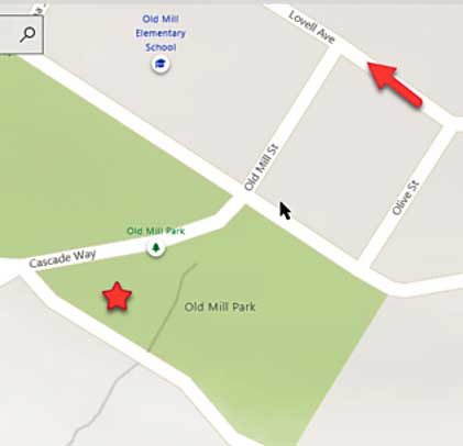
Old Mill Park is bounded by Cascade Way and Throckmorton Avenue in Mill Valley. Because this is a popular park and a major starting point for the Dipsea Trail, it can be hard to find parking, especially nearby on Throckmorton Avenue. Alternate parking is on the other side streets but be aware that Lovell Ave. is a one way street.
My preference has been to come early before the “crowd” arrives and if there is time, make the 10-minute walk down Throckmorton Avenue to Peet’s Coffee and Tea and enjoy the plaza if the weather is nice.
Because there can be a lot of shade in this park and because it sits in a low spot, temperatures can be quite chilly, so plan accordingly.
37.905278, -122.552500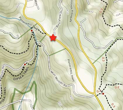
Windy Gap is located at the west side of Panoramic Hwy where it intersects with Bay View Drive. The Dipsea Trail diagonally crosses the Panoramic Hwy at this location. The event organizers should have a safety person there to assist runners in crossing the highway. Although this is not part of our ham radio responsibilities, it is advisable to wear an orange safety vest and to be aware on oncoming traffic. Weather conditions can be variable here, so plan accordingly with sun screen as well as warm clothing.
301 Panoramic Hwy, Mill Valley, CA 9494137.896872, -122.5604
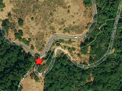
Muir Woods Mailboxes are located at the mailboxes at the junction of Camino del Canyon and Muir Woods Road.
61 Camino del Canyon, Mill Valley CA 9494137.892709, -122.565848
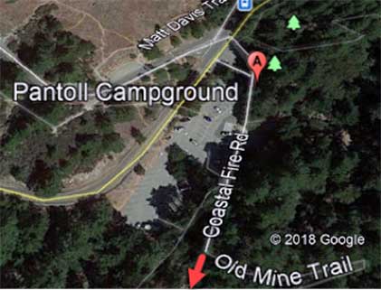
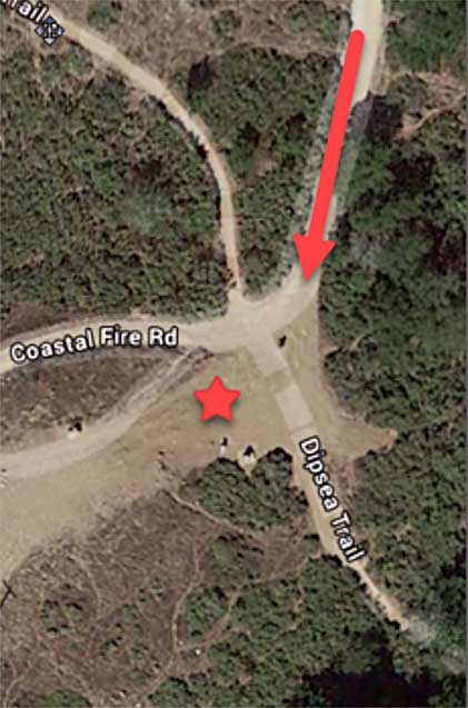
Cardiac is located near Pantoll State Park off of Panoramic Highway (3801 Panoramic Hwy, Mill Valley). Turn into Pantoll State Park and rather than turning to the right into the parking lot, continue straight across the parking lot to the access road on your right. As you start to drive this road, the rest rooms will be on your left. Exercise extreme caution because of the pedestrian and bicyclists in this area and along this road which will take you past the small administrative buildings on your right. Continue on until you reach the maintenance/storage yard. Drive on through and look for a gate on the left where you will continue driving along the access road (Google Earth labels this as the Coastal Fire Road). Continue driving until you leave the wooded area and you will see the aid station below you at the intersection of Coastal and the Dipsea Trails. Avoid driving down to this intersection and park so you are completely off the road because this is a fire and emergency access road.
There is very limited shade at this location, so be sure to bring sun screen and a hat, but also warm clothing. Expect the unexpected.
3801 Panoramic Hwy, Mill Valley CA 9494137.904219, -122.604058
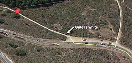
White Gate is named for the (almost) white gateat the eastern end of the parking area off of the Panoramic Highway. Park and pass through this gate and walk down the jeep trail approximately 200 yards until you come the jeep road where it crosses the Dipsea Trail. Runners for this event will likely take a shortcut by running up the jeep road you just came down or they may choose to continue on the Dipsea Trail. It is their choice.
5968 Panoramic Hwy, Stinson Beach CA 9497037.892249, -122.62496
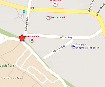
Red star shows approximate location.
Stinson Beach Turn is located at the foot bridge on Arenal Avenue, near Parkside Café outside of the State Park, in front of the phone company. You will see the runners only one time. Be prepared for cool weather at this location.
37.897919, -122.639928
