| Station |
Location |
GPS |
Equipment / Repeater |
Station Information |
Stinson Beach State Park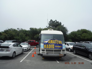 |
Start at Stinson Beach State Park, Highway 1, Stinson Beach. NOTE: Hours are changed in 2017. |
37.896747N & 122.639102W |
Mobile Radio – Gain Antenna on a Pole / Tam or Big Rock Input |
Fixed Location. Communicates with all stations, and interfaces with Race Officials and EMS. The Start line announces live the beginning of the race, and announces live when the scratch runners begin. |
Insult Hill / White Gate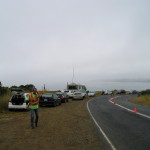
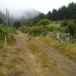 Steep Ravine Fire Road |
Fire Gate on Panoramic Highway about 1 Mile South of Stinson Beach. Dipsea Trail splits from fire road 1/4 mile south of fire gate. Runners use both paths.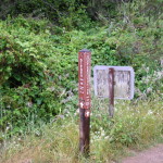 NOTE: Hours are changed in 2017. NOTE: Hours are changed in 2017. |
37.891470N & 122.623267W |
Mobile Radio – Gain Antenna / Tam or Big Rock Input on 146.700. 147.330 works well at this location.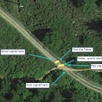 |
Fixed Location. Announce live the numbers of the first 5 participants to pass (in both directions), and relay the numbers of the last 5 participants to Net Control. |
Cardiac Hill |
On Dipsea Trail, at fire road, 1/4 mile West of Pan Toll Ranger Station. NOTE: Hours are changed in 2017. |
37.897401N & 122.601326W |
Mobile Radio – Mag Mount Antenna / Tam Input on 146.700. 147.330 works well at this location. |
Fixed position. Announce live the numbers of the first 5 participants to pass (outbound and inbound), and relay the numbers of the last 5 participants to Net Control. |
| Muir Woods Park |
Muir Woods National Park, at maintenance area. NOTE: Hours are changed in 2017. |
37.891737N & 122.568940W |
Mobile Radio – Mag Mount Antenna / Tam Input on 146.700. 147.330 works well at this location. |
Fixed position. Announce live the numbers of the first 5 participants to pass (outbound and inbound), and relay the numbers of the last 5 participants to Net Control. |
| Windy Gap |
Panoramic Highway at Dipsea Trail Crossing, near Bay View Ave. Mill Valley. NOTE: Hours are changed in 2017. |
37.897096N & 122.561005W |
Handheld Radio – Gain Antenna / Tam Input on 146.700. 147.330 works well at this location. |
Fixed position. Announce live the numbers of the first 5 participants to pass (outbound and inbound), and relay the numbers of the last 5 participants to Net Control. |
| Old Mill Park |
Throckmorten and Old Mill, Mill Valley, Turn-Around. NOTE: Hours are changed in 2017. |
37.904990N & 122.553220W |
Mobile Radio – Mag Mount Antenna / Tam Input on 146.700. 147.330 works well at this location. |
Fixed position. Announce live the numbers of the first 5 participants to pass, and relay the numbers of the last 5 participants to Net Control. |
| Windy Gap |
Panoramic Highway at Dipsea Trail Crossing, near Bay View Ave. Mill Valley. NOTE: Hours are changed in 2017. |
37.897096N & 122.561005W |
Handheld Radio – Gain Antenna / Tam Input on 146.700. 147.330 works well at this location. |
Fixed position. Announce live the numbers of the first 5 participants to pass (outbound and inbound), and relay the numbers of the last 5 participants to Net Control. |
| Muir Woods Park |
Muir Woods National Park, at maintenance area. NOTE: Hours are changed in 2017. |
37.891737N & 122.568940W |
Mobile Radio – Mag Mount Antenna / Tam Input on 146.700. 147.330 works well at this location. |
Fixed position. Announce live the numbers of the first 5 participants to pass (outbound and inbound), and relay the numbers of the last 5 participants to Net Control. |
Cardiac Hill |
On Dipsea Trail, at fire road, 1/4 mile West of Pan Toll Ranger Station. NOTE: Hours are changed in 2017. |
37.897401N & 122.601326W |
Mobile Radio – Mag Mount Antenna / Tam Input on 146.700. 147.330 works well at this location. |
Fixed position. Announce live the numbers of the first 5 participants to pass (outbound and inbound), and relay the numbers of the last 5 participants to Net Control. |
Insult Hill / White Gate
 Steep Ravine Fire Road |
Fire Gate on Panoramic Highway about 1 Mile South of Stinson Beach. Dipsea Trail splits from fire road 1/4 mile south of fire gate. Runners use both paths. NOTE: Hours are changed in 2017. NOTE: Hours are changed in 2017. |
37.891470N & 122.623267W |
Mobile Radio – Gain Antenna / Tam or Big Rock Input on 146.700. 147.330 works well at this location. |
Announce live the numbers of the first 5 participants to pass (in both directions), and relay the numbers of the last 5 participants to Net Control. |
Stinson Beach State Park |
Finish at Stinson Beach State Park, Highway 1, Stinson Beach. NOTE: Hours are changed in 2017. |
37.896747N & 122.639102W |
Mobile Radio – Gain Antenna on a Pole / Tam or Big Rock Input on 146.700. 147.330 works well at this location. |
Communicates with all stations, and interfaces with Race Officials and EMS. The Finish Line reports the first finisher, and when all participants are in. |


 NOTE: Hours are changed in 2017.

 NOTE: Hours are changed in 2017.

![]()


