|
|
| NOTE: If your assignment takes anywhere where you might be at risk of tick bites, TAKE PRECAUTIONS! Ticks in this area carry Lyme Disease. |
Overview: The Dipsea Race has used basically the same route for 100 + years. Marin Amateurs have been providing communications for many years. The race is a handicapped start event, that begins in Downtown Mill Valley, and ends at Stinson Beach State Park. Radio Volunteers need to be in place before the race start.
| The Start line announces live the beginning of the race, and announces live when the scratch runners begin. |
| NOTE TO ALL STATIONS: It is important that Net Control gets the live announcements of starts from the Start. The following stations are to announce live the first ten runners numbers and the first female runner number as the pass through: Windy Gap, Muir Woods, Cardiac Hill, and White Gate. |
| All stations advise Net Control of the numbers of the final runners and arrival of the sweep. |
| Of course, EMERGENCY TRAFFIC always has priority. |
| We have described the station locations, based in the best information we have. The equipment recommendations are based on past experience. Volunteers should be prepared for changing conditions. If you have photos of locations to share, or GPS co-ordinates, e-mail them to: ka6bqf@sbcglobal.net |
| Click on the “Station” to view a Map |
| Station | Location | GPS | Information | Equipment / Repeater |
| Dipsea Start | Lytton Square, Throckmorten Ave and Miller Ave, Mill Valley | 37.906478N & 122.548014W | This is the start of the race. This station announces the start of the race (live), and announces the start of the Scratch Runners (live), the final group to hit the trail. | Handheld Radio – Directional Antenna on a Pole / Tam Input on 146.700. 147.330 works well. |
| Old Mill Park | Throckmorten Ave and Old Mill Ave, Mill Valley | 37.904990N & 122553220W | Not Staffed on The Dipsea | |
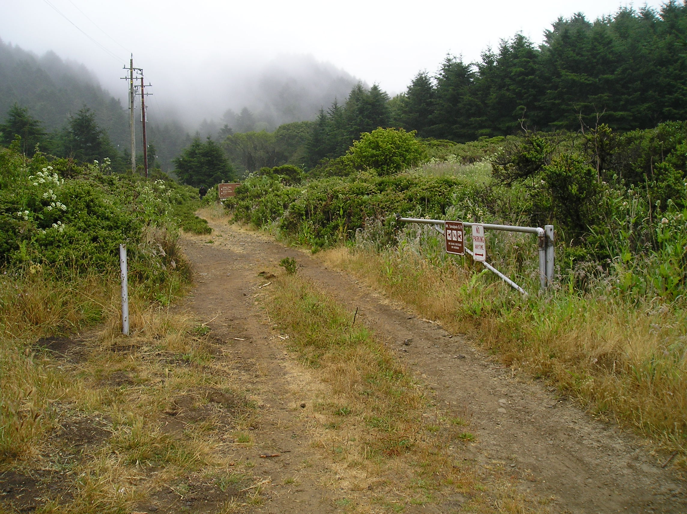
| Windy Gap | Panoramic Highway at Dipsea Trail Crossing, near Bay View Ave., Mill Valley | 37.897096N & 122.561005W | Fixed position. Announce live the numbers of the first 10 participants to pass, and relay the numbers of the last 5 participants to Net Control. | Handheld Radio – Gain Antenna / Tam Input on 146.700. 147.330 works well. |
| Muir Woods Park | Muir Woods National Park, At Park Maintenance Area | 37.891737N & 122.568940W | Fixed position. Announce live the numbers of the first 10 participants to pass, and relay the numbers of the last 5 participants to Net Control. | Mobile Radio – Mag Mount Antenna / Tam Input on 146.700. 147.330 works well. |
| Dynamite Hill | Rise out of Muir Woods on Dipsea Trail | ~37.889694N & 122.576592W | Not Staffed on Dipsea | Handheld Radio – Gain Antenna / Tam Input on 146.700, or Local to Muir Woods. 147.330 works well. |
| Deer Park | 1 mile East of Cardiac Hill, on Dipsea Trail, at Deer Park Fire Road | ~37.898127N & 122.596847W | Hike-in Location. Announce the arrival of the first runner, and the final runners, plus the sweep. | Handheld Radio – Gain Antenna / Tam Input on 146.700, or Local to Cardiac. 147.330 works well. |
Cardiac Hill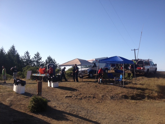 |
On Dipsea Trail, at Coastal Fire Road, ~1/2 mile West of Pan Toll Ranger Station | 37.897401N & 122601326W | Fixed position. Announce live the numbers of the first 10 participants to pass, and relay the numbers of the last 5 participants to Net Control. | Mobile Radio – Mag Mount Antenna / Tam Input on 146.700. 147.330 works well. |
| Lone Pine | ~ 1/2 mile West of Cardiac Hill, on the Dipsea Trail | ~37.896011N & 122.604321W | Staffed if we have available operators. Hike-in Location. Announce the arrival of the first runner, and the final runners, plus the sweep. | Handheld Radio – Gain Antenna / Tam Input on 146.700, or Local to Cardiac. 147.330 works well. |
| Top of the Swoop | 1 1/4 Miles West of Cardiac Hill, at Ben Davis Trail Junction | ~37.892307N & 122.613593 | Staffed if we have available operators. Hike-in Location. Announce the arrival of the first runner, and the final runners, plus the sweep. | Handheld Radio – Gain Antenna / Via Crossband at White Gate. 147.330 works well. |
| Top of the Steep Ravine Stairs “Top of Stairs” | Trail past the Bottom of the Swoop, at the upper end of Steep Ravine Steps. 3/4 mile up from White Gate / Insult Hill. | ~37.892045N & 122.616677W | Staffed if we have available operators. Hike-in Location. Announce the arrival of the first runner, and the final runners, plus the sweep. | Handheld Radio – Gain Antenna / Via Crossband at White Gate, 147.330 works well. |
Steep Ravine Bridge 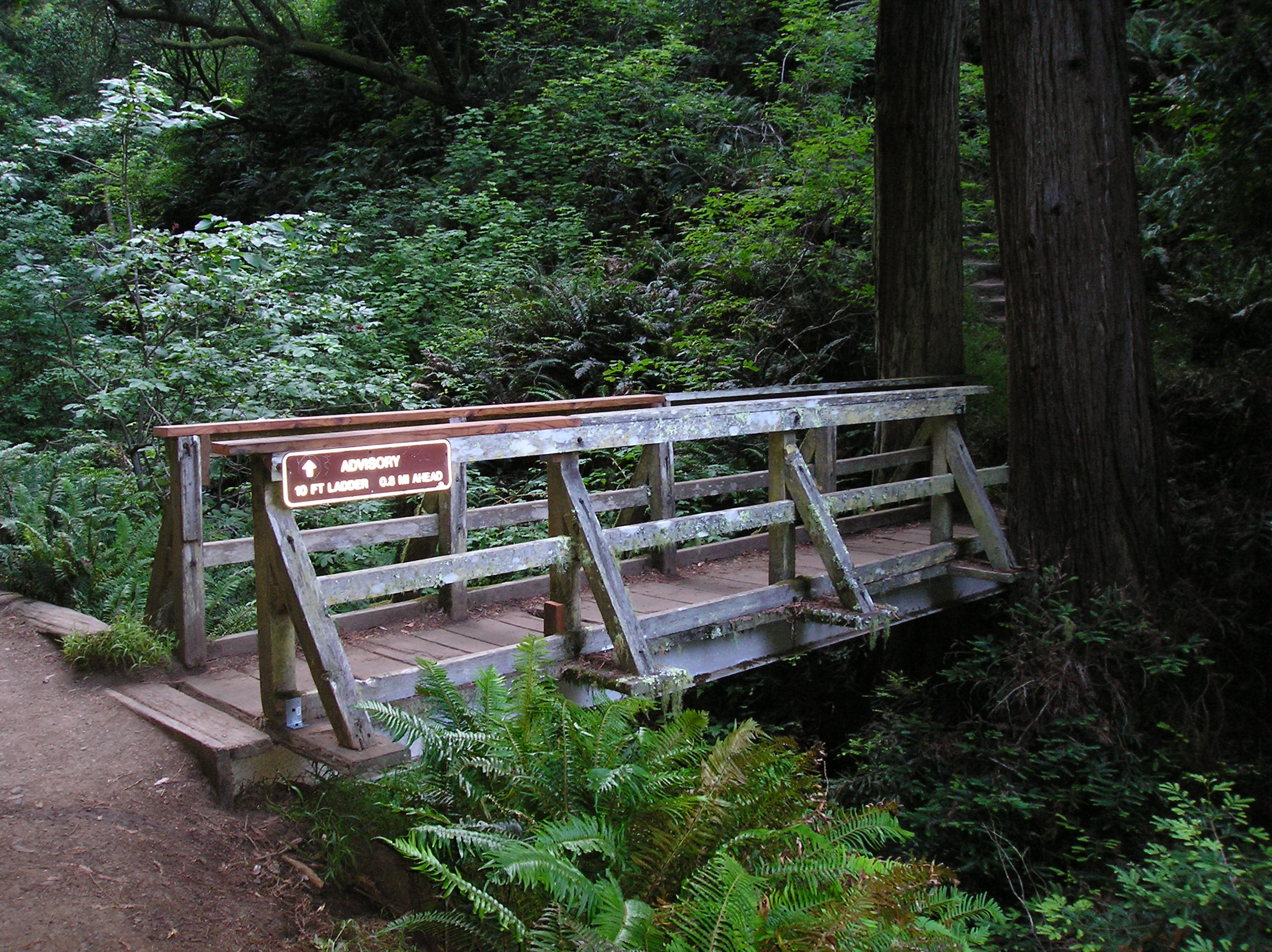 |
At the Bottom of the Steep Ravine Stairs, 1/4 mile East of White Gate at Steep Ravine Trail | ~37.891559N & 122.620895W | Staffed if we have available operators. Hike-in Location. Announce the arrival of the first runner, and the final runners, plus the sweep. | Handheld Radio – Gain Antenna / Via Crossband at White Gate |
Insult Hill / White Gate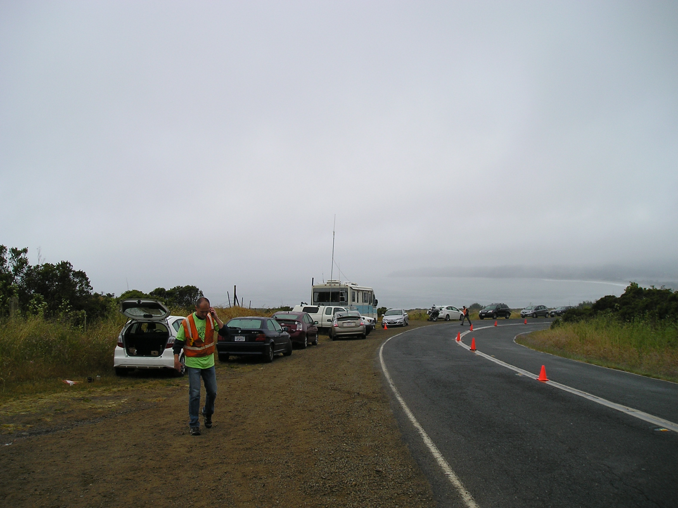 |
Fire Gate on Panoramic Highway about 1 Mile South of Stinson Beach. Dipsea Trail splits from fire road 1/4 mile south of fire gate. Runners use both paths.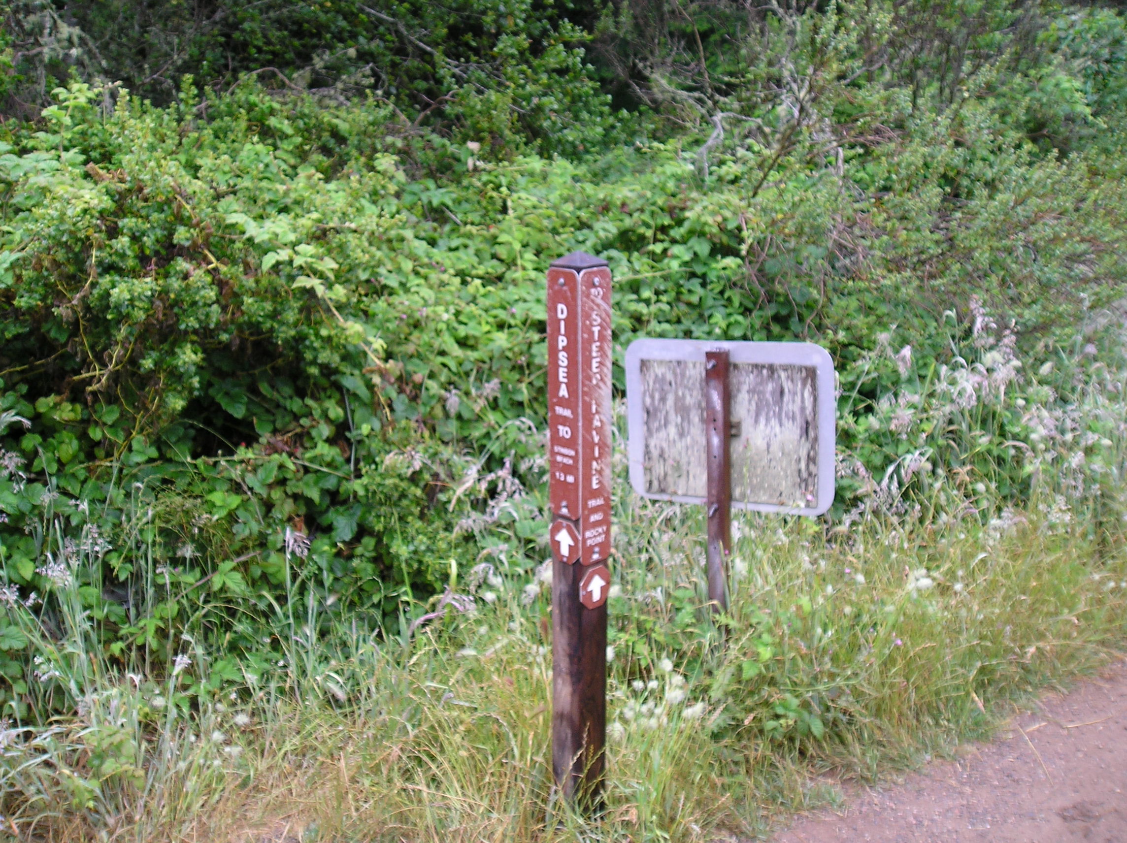
 Steep Ravine Fire Road |
37.891470N & 122.623267W | Announce live the numbers of the first 10 participants to pass, and relay the numbers of the last 5 participants to Net Control. | Mobile Radio – Gain Antenna on a Pole / Tam or Big Rock Input on 146.700 – Handheld Radio – Gain Antenna / Via Crossband at White Gate. 147.330 works well.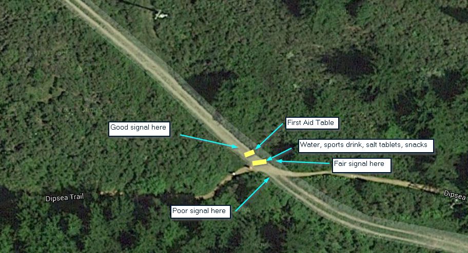 |
| Moors | Open Grassy Area Between White Gate and Highway 1 | ~37.893100N & 122.630769W | Usually not Staffed | Handheld Radio – Gain Antenna / Via Crossband at White Gate. Simplex to Net Control works well. |
| Panoramic Hwy & Hwy 1 | Trail Crossing ~70 Yd up on Panoramic Highway, at Junction with Highway 1. | 37.896541N & 122.635905W | Announce the arrival of the first runner, and the final runners, plus the sweep. | Direct to Net Control on Output of Repeater or Local Tactical |
| Dipsea Finish | Stinson Beach State Park, Finish Line at Stinson Beach State Park, Highway 1, Stinson Beach | 37.895813N & 122.638053W | Keep the announcer apprised of the progress of the race. | Direct to Net Control on Output of Repeater or Local Tactical |
| Dipsea Medical Tent | Stinson Beach State Park, near Finish Line at Stinson Beach State Park, Highway 1, Stinson Beach | Advise medical personnel of any incoming injuries that are relayed over the radio. | Direct to Net Control on Output of Repeater or Local Tactical | |
| Stinson Beach Dipsea Net Control | 2016 & 2017 County Communications Van, Stinson Beach State Park Parking Lot | 37.896476N & 122.639204W | Communicates with all stations, and interfaces with Race Officials and EMS. Briefing with officials at 07:00. | Multiple Mobile Radios – Gain Antenna on a Pole / Tam or Big Rock Input plus Local Tactical 147.330 works well. |
| Dipsea Radio Hiker | Hikes / runs with the Dipsea Sweep. Sweeps check that the Course is Clear. | Checks in at every station. Reports any issues with runners to Net Control, or nearest station. | Handheld Radio / Use Any Input That Works. 147.330 works well on most of the course. Simplex to Net Control works from Steep Ravine on. |
Return to Dipsea Page
Return to Public Service List
![]()
Last Revised: 06/09/2017