| Last Update: | 04/20/2017 |
 The Bay Area’s most gorgeous hike and ride – along the Ridge Trail through Marin and across the Golden Gate. The Bay Area’s most gorgeous hike and ride – along the Ridge Trail through Marin and across the Golden Gate. |
|
| NOTE: TICK BLOOM – We have been informed of a ‘tick bloom’ on Mt. Tam, in late April, 2016. If your assignment takes anywhere where you might be at risk, TAKE PRECAUTIONS! Ticks in this area carry Lyme Disease. | |
Overview:
All participants check-in at the start/finish, and are bussed to their drop-off points to begin their hike, run or ride. Currently hikers and bicyclists begin and finish at the Presidio in San Francisco. 10 Mile Hikers hike from the Presidio to Tennessee Valley and are bussed back.
All stations are to announce arrival of the hiker / runner/ cyclist groups as they pass through.
All stations advise Net Control of the numbers of the final hiker group and arrival of the radio hikers.
We have described the station locations as best we can. Station locations may change from year to year. The equipment recommendations are based on past experience. Volunteers should be prepared for changing conditions.
Click on the “Station” to view a Map
| Station / Assignment | Location / Description | GPS | Equipment / Repeaters | |
Presidio Transit Center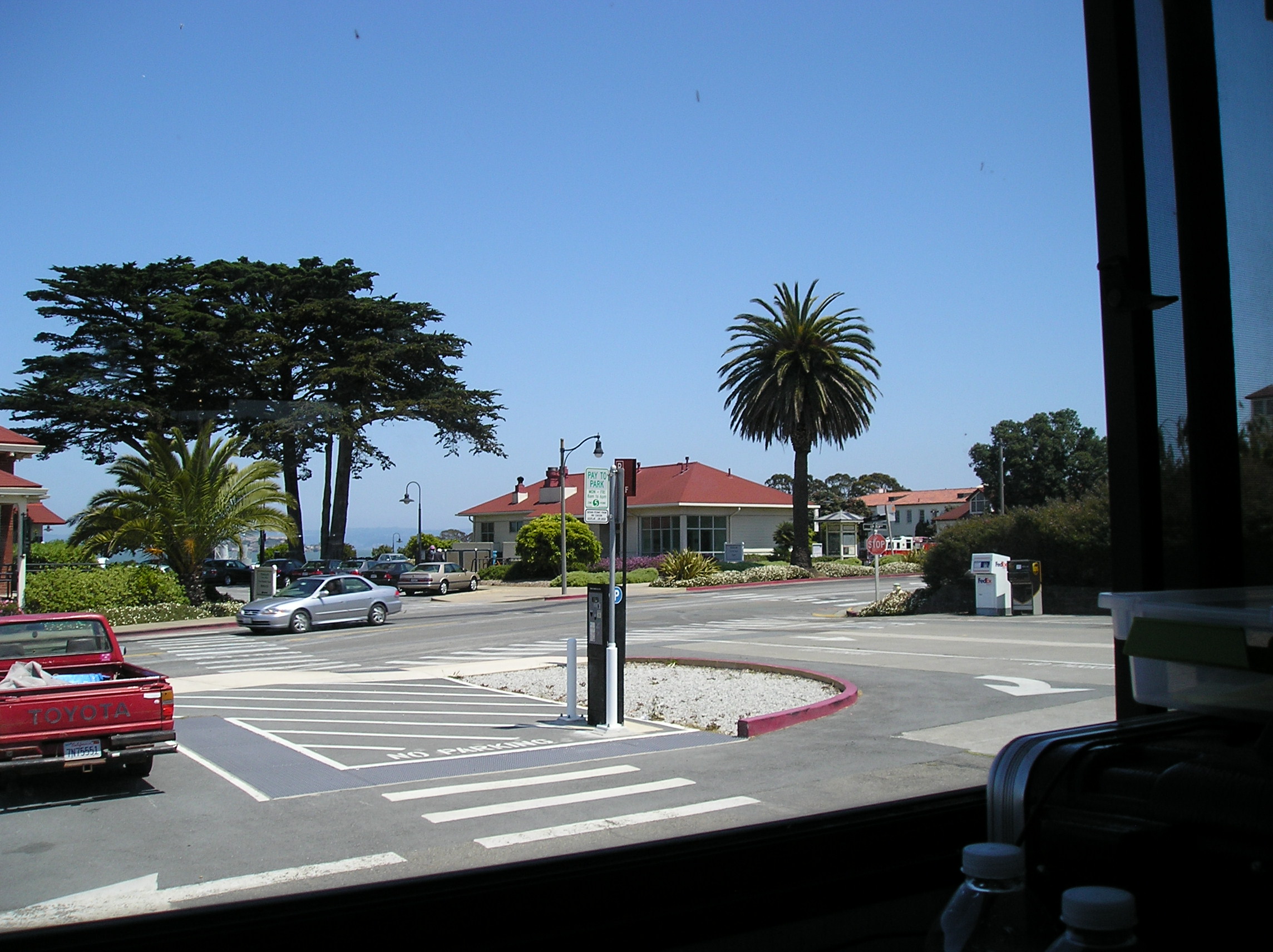 |
216 Lincoln Blvd at Graham Street, San Francisco, North of the Main Post Parade Ground parking lot. | 37.799428N & 122.458671W | Gain Antenna and Mobile Radio / Use Tam or Big Rock Input or Tam West VHF Repeater. Buildings shield path to the repeater. Set-up at the northeast corner of the sidewalk for best signals, or set up crossband. Signals improve in the parking lot north of the fire station. | |
| Net Control |
216 Lincoln Blvd at Graham Street, San Francisco, Net Control will be in parking lot north of Fire Station 51, northeast of the Transit Center. | ~37.801736N & 122.455084W | Gain Antenna and Mobile Radio / Use Tam or Big Rock Input or Tam West VHF Repeater. | |
| Sam Taylor State Park Drop-off | Sir Francis Drake Blvd at Bike Trail past entrance to SPT Park (Near Jewell) | ~38.029400N & 122.742121W | Gain Antenna and Mobile Radio / Use Barnabe Input or Tam West VHF Repeater. | |
| McKennan Gulch Trail & W. Ridgecrest Blvd. | W. Ridgecrest Blvd. & McKennan Gulch Trail & Coastal Trail [ADDED 2017] | ~37.9245175N & 122.6422921W | Gain Antenna and Mobile Radio / Use Any Input or Tam West VHF Repeater. | |
Bolinas Ridge Trail at Bo-Fax  |
Bolinas-Farifax Road at Ridgecrest Blvd. / Bolinas Ridge Rd. / Coastal Trail [Bikes Only 2017] | 37.939379N & 122.658455W | Gain Antenna and Mobile Radio / Use Any Input or Tam West VHF Repeater. | |
Cardiac Hill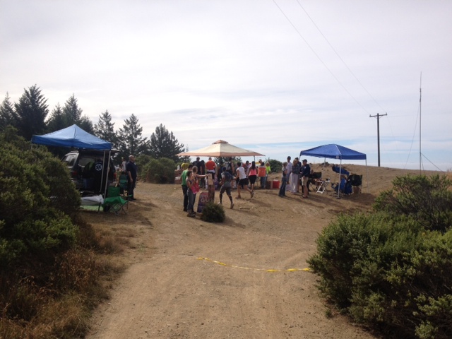 |
1/2 mile down service road (Coastal Fire Road) from Pan Toll Ranger Station at Dipsea Trail | 37.897401N & 122.601326W | Gain Antenna and Mobile Radio / Use Tam or Big Rock Input or Tam West VHF Repeater. | |
| Muir Beach/ Golden Gate Dairy Stables[NOT USED 2017] | 1760 Shoreline Highway, across from the Pelican Inn, Muir Beach[NOT USED 2017] | 37.8649479N & 122.5768801W | Gain Antenna and Mobile Radio / Use Tam Input or Tam UHF or Tam West VHF Repeater | |
| Panoramic Rest Stop / Dias Ridge Trailhead [2017] | 52 Panoramic Highway, Sausalito [Added 2017] | 37.8849704N & 122.5569042W | Gain Antenna and Mobile Radio / Use Tam or Big Rock Input or Tam West VHF Repeater | |
| Highway 1 – Miwok Trail Crossing | Highway 1, at Miwok Trail Crossing, South of Muir Beach | 37.879361N & 122.554570W | Gain Antenna and Mobile Radio / Use Tam or Big Rock Input or Tam West VHF Repeater | |
| Tennessee Valley | South end of Tennessee Valley Road, parking lot & picnic site. | 37.860783N & 122.535634W | Gain Antenna and Mobile Radio / Use Tam or Big Rock Input or Tam West VHF Repeater | |
Golden Gate Bridge 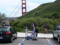 |
North Parking Lot, West of Highway 101 | 37.832515N & 122.482071W | Gain Antenna and Mobile Radio / Use Tam Input or Tam West VHF Repeater or Simplex Direct to Net Control in Presidio | |
| Presidio Transit Center |
216 Lincoln Blvd at Graham Street, San Francisco, North of the Main Post Parade Ground parking lot. | 37.799428N & 122.458671W | Gain Antenna and Mobile Radio / Use Tam or Big Rock Input or Tam West VHF Repeater. Buildings shield path to the repeater. Set-up at the northeast corner of the sidewalk for best signals, or set up crossband. Signals improve in the parking lot north of the fire station. | |
Presidio Main Post Parade Ground 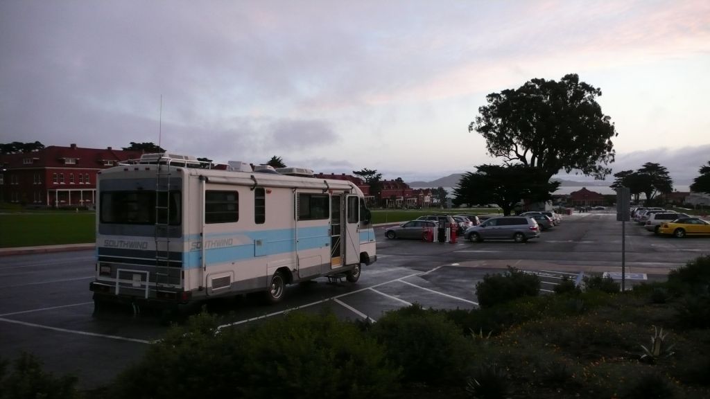 |
Parking Lot between Lincoln & Sheridan, off Anza | 37.799428N & 122.458671W | Gain Antenna and Mobile Radio / Use Tam or Big Rock Input or Tam West VHF Repeater | |
Hiker 1  |
Hikes along with assigned hiker group, checks in at Start, rides bus with assigned group. Plan to report 15 at least minutes before your bus departs. | Handheld Radio / Use Any Input That Works or Tam West VHF Repeater or Simplex to Net Control. | ||
| Hiker 2 | Hikes along with assigned hiker group, checks in at Start, rides bus with assigned group. Plan to report 15 at least minutes before your bus departs. | Handheld Radio / Use Any Input That Works or Tam West VHF Repeater or Simplex to Net Control. | ||
| Hiker 3 | Hikes along with assigned hiker group, checks in at Start, rides bus with assigned group. Plan to report 15 at least minutes before your bus departs. | Handheld Radio / Use Any Input That Works or Tam West VHF Repeater or Simplex to Net Control. | ||
| Hiker 4 | Hikes along with assigned hiker group, checks in at Start, rides bus with assigned group. Plan to report 15 at least minutes before your bus departs. | Handheld Radio / Use Any Input That Works or Tam West VHF Repeater or Simplex to Net Control. | ||